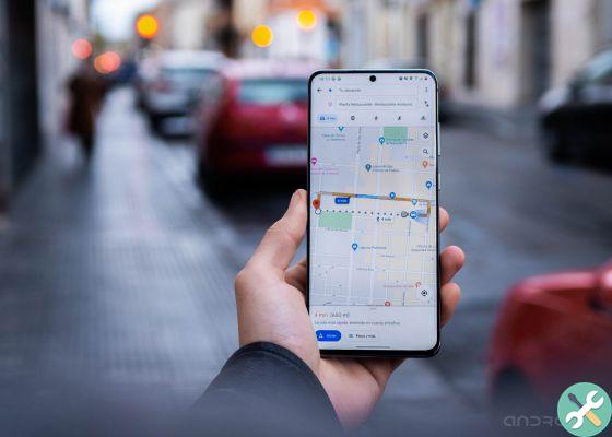
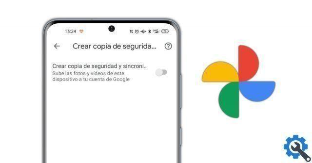
Google continues to add useful features to Google Photos, its cloud photo storage platform. So he announced that he was working on greater synchronization of Photos with Google Maps in the form of a feature called "Explore Map" that you shows the location where you took all the photos that you store on the platform.
After a long time requesting this feature, users (including you) can see all images in a geolocated heat map and therefore to know the place in which they have made each one. Thanks to this tool you can find out which are the cities where you have taken the most photos or which are the exact places that most bring you to take your mobile phone to use the camera.
Google Photos Trick: How to See All Your Photos in a Geolocated Heat Map
Last June was a time of major changes for Google Photos, which released a new logo and received a major makeover. Among the changes was there the introduction of a new map view, which would have made it possible to more accurately identify the place where the photos were taken.
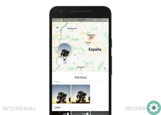
Here's what Google Photos geolocated heat map looks like to locate all your images
This interactive map is already a reality and in this article we will explain how to use it. First of all, you should know that the map uses the GPS information from the camera, the Google Maps location history turned on, the landmarks detected and those locations you entered manually. As they say, the map is fully interactive so you can zoom in, out or move to analyze positions in detail of your photos.
This is a geolocated heat map, so you will be able to see highlight in color the points where you took more photos. We don't make you wait any longer, let's see how to access this Google Photos heat map to see the location of all the photos you store there.
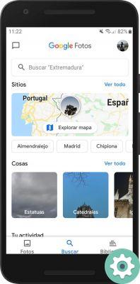
- Open Google Photos and click "Near" in the lower navigation map.
- On the new page, within the section "Places", you will be able to see the map and buttons with the most popular locations among your photos to give you direct access to them. Click on the map for a brief introduction to the Explore Map feature.
- This will give you access to Google Photos' geo-located heat map, which you can zoom in or out to see the locations of your photos more clearly. Click on a spot to access all captured images in that position, which will appear in the lower half of the screen. To see a large photo, you just have to select it.
It is very easy to use the geo-localized heat map of Google Photos, a tool with which you can locate all the images and thus discover which are the places where you have taken the most photos. Also, you have to keep in mind that the images you downloaded from the web keep their original position, then you can see a location marked on the map where you haven't really been.
If you still don't like this feature on your Android device, remember that you have to update the app to get the latest news. Gradually, thanks to tricks like this or the hidden gesture that allows you to choose the speed with which to move around the gallery, you can dominate Google Photos to get the most out of this fantastic app.